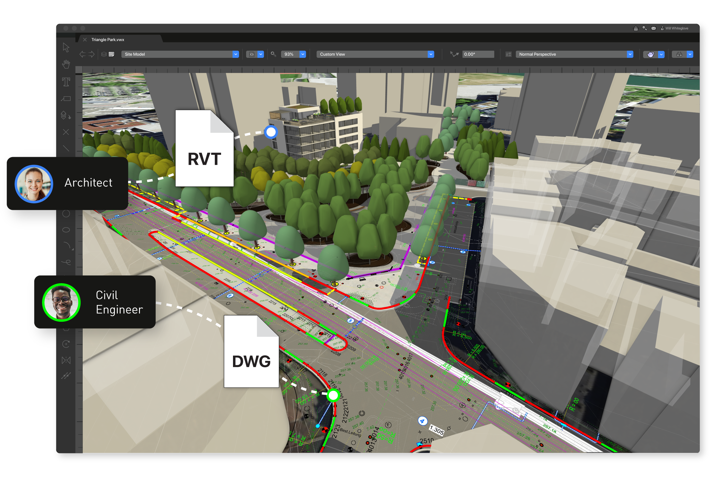
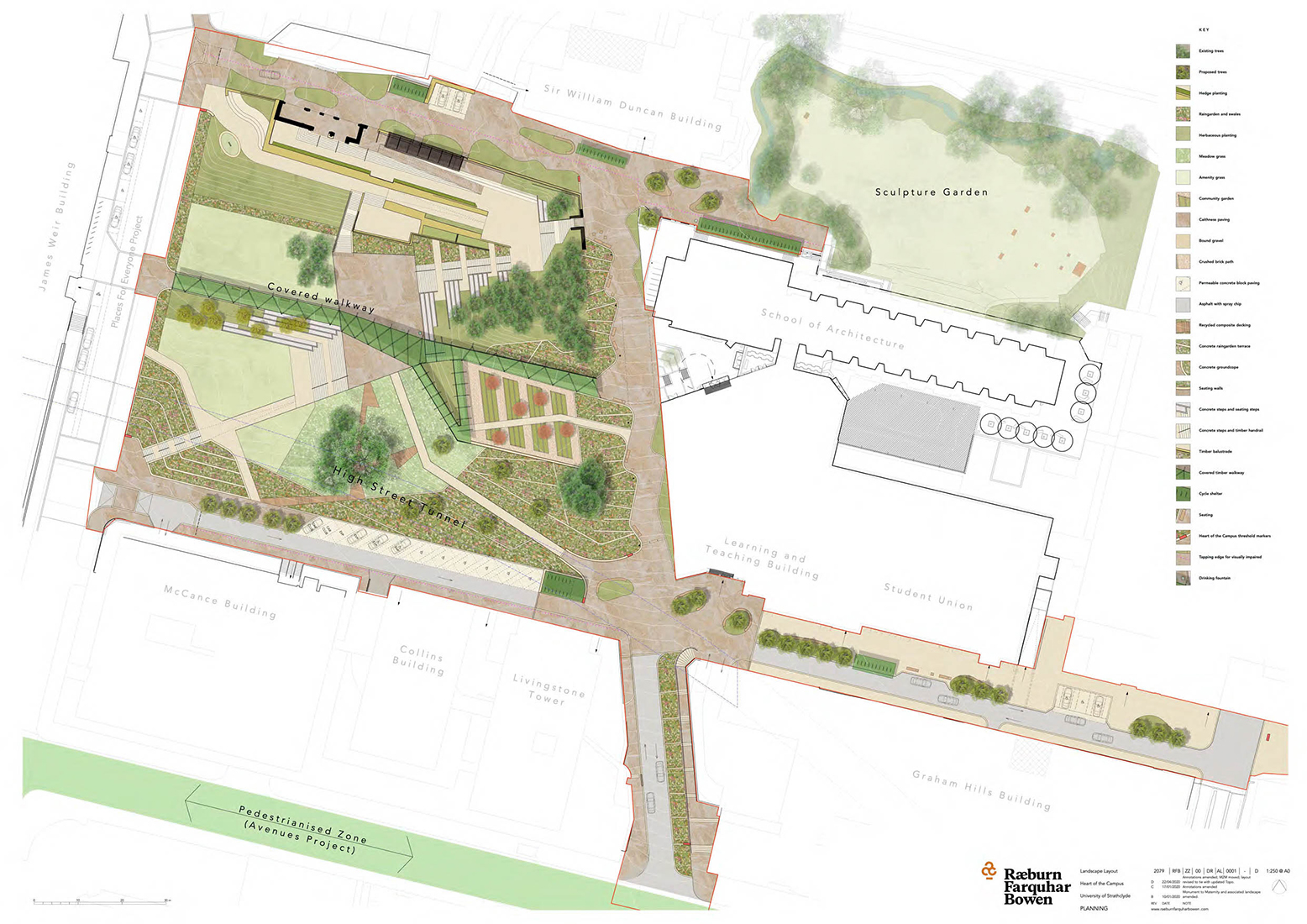
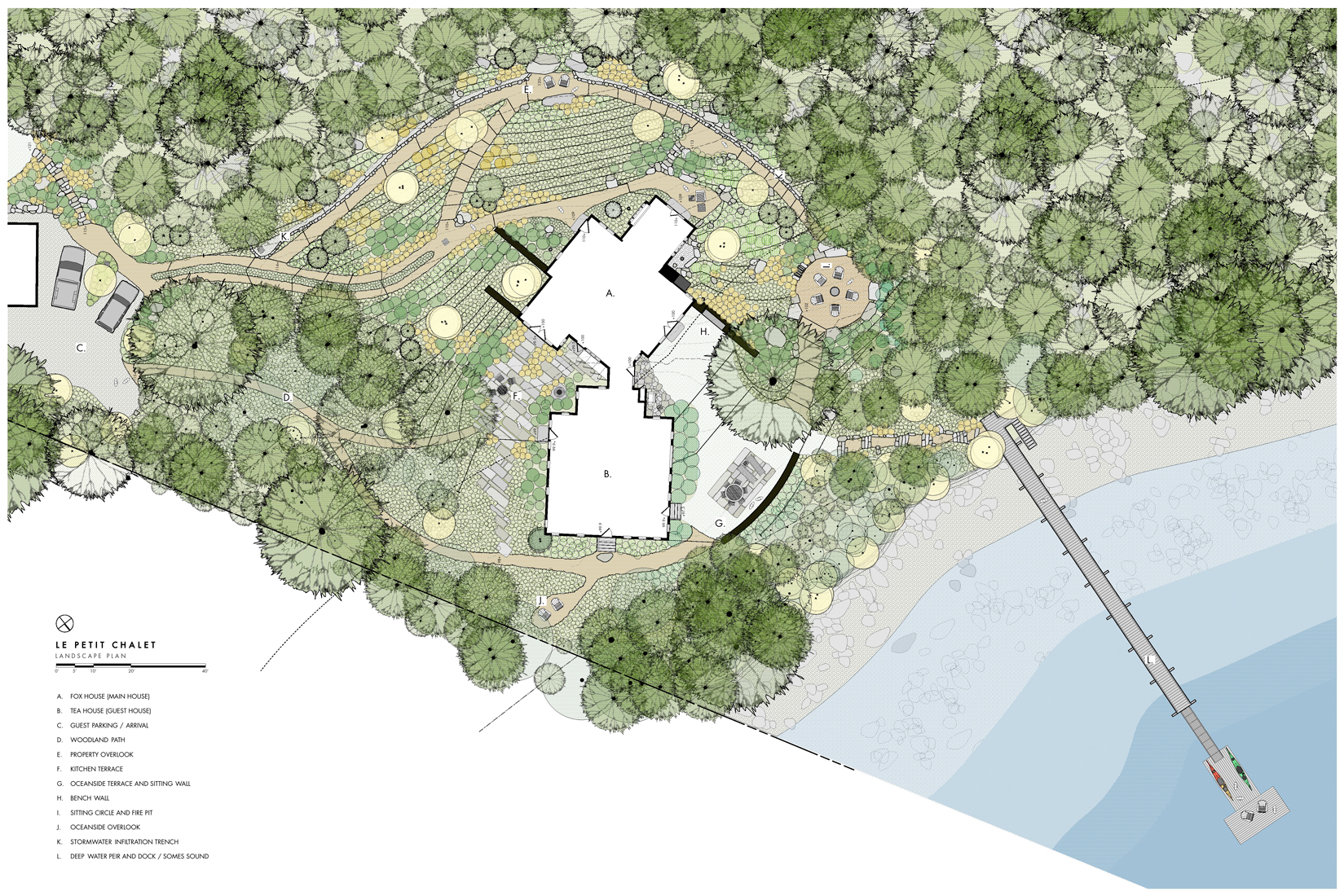
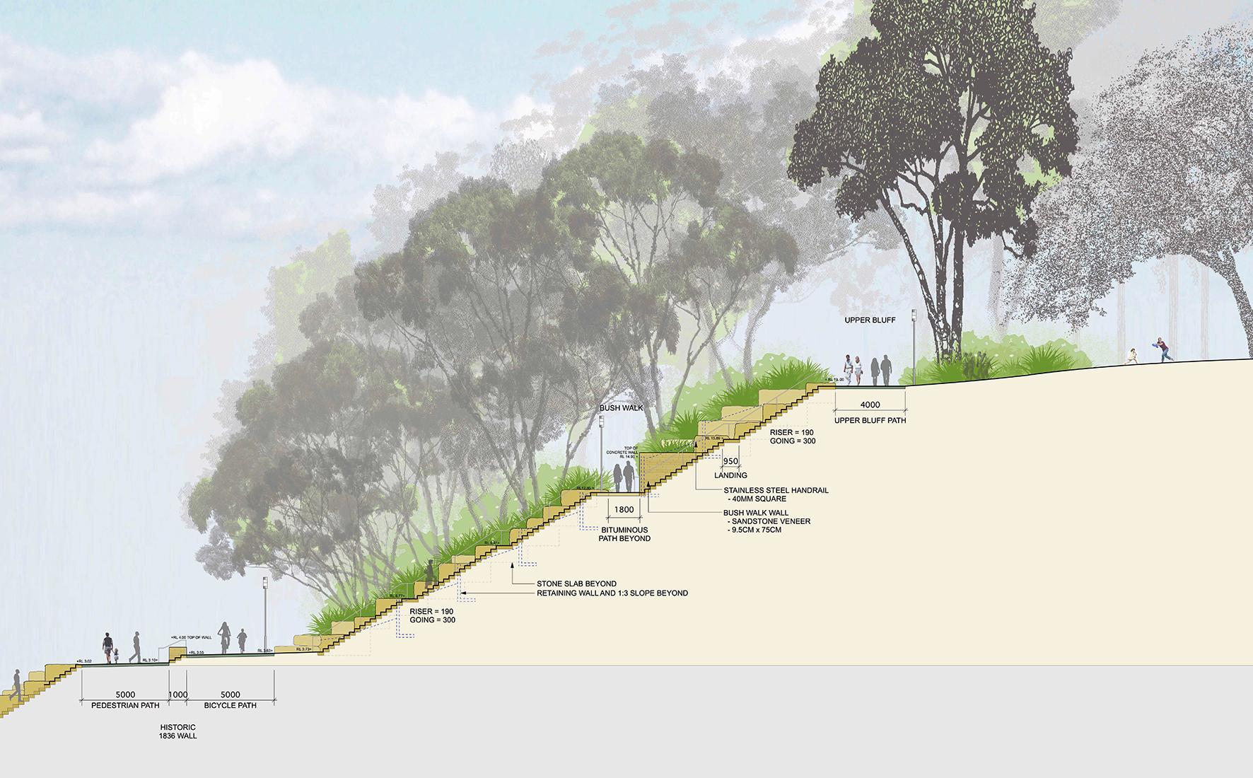
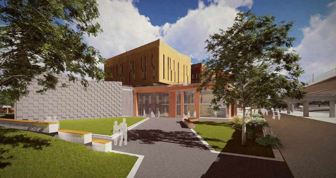
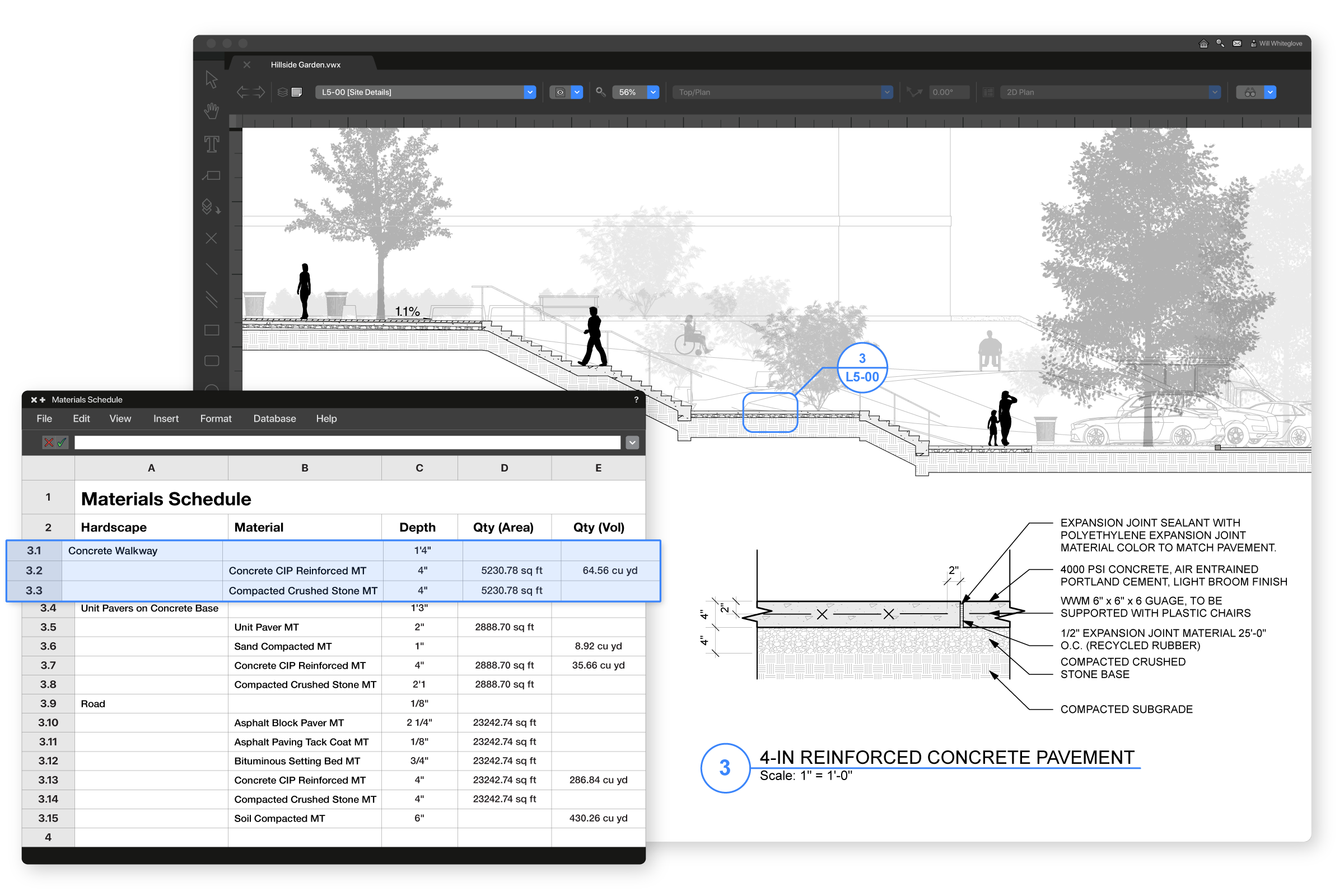
VectorWorks Home VectorWorks Home
VectorWorks Home
You need to upgrade your Flash Player
Click here to go to the 12.5 Upgrade page.
             
    VectorWorks Landmark 12- Mapping and GIS    
NNA Home Page
Products
Markets
How To Buy VectorWorks

Landmark Home Page
Features
New in 12
Gallery
Support

© 2008 Nemetschek North America


You can easily import maps and aerial photographs or even scan in site data with VectorWorks Landmark. Plus, new import and export options make it easy to work with GIS maps and data. With support for Shapefiles (.SHP files), you can import georeferenced maps and map data into your drawings. You can use these maps as they are or use the outstanding drawing, modeling and graphics capabilities within

VectorWorks Landmark to embellish them. .SHP export allows maps created in VectorWorks Landmark to be shared with colleagues using other GIS and mapping programs.


VectorWorks Landmark 12 - Mapping and GIS